
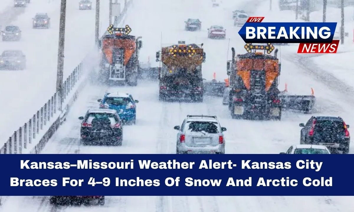
A powerful winter storm is impacting the Kansas–Missouri region today, bringing heavy snowfall and dangerous Arctic cold to the Kansas City metro area.
Weather officials have issued a Winter Storm Warning covering large parts of the region through Sunday evening, warning residents to prepare for snow-covered roads, reduced visibility, and extremely cold temperatures.

This system combines steady snowfall with plunging temperatures, creating conditions that can quickly become hazardous. The storm is expected to affect daily travel, weekend plans, and outdoor safety across both Kansas and Missouri.
Snowfall Forecast For Kansas City
The most significant impact from this system is snow accumulation. Forecast models indicate widespread totals of 4–9 inches of snow across the Kansas City area, with amounts varying depending on location and snowfall bands.
Some areas are expected to receive 4–6 inches of additional snow during the warning period, while communities that remain under heavier snow bands could approach the higher end of the forecast range. Snowfall rates may intensify at times, leading to rapid accumulation on untreated roads.

Because temperatures remain well below freezing, snow will not melt quickly, increasing the risk of slick streets, icy bridges, and dangerous driving conditions.
Arctic Cold And Wind Chill Threat
This storm is also delivering a surge of Arctic air, making conditions far more dangerous than a typical snow event. Temperatures in the Kansas City region are hovering near 1°F, with wind making it feel even colder.
The combination of snow and bitter cold raises the risk of frostbite and hypothermia, especially for anyone spending extended time outdoors. Wind chills can cause exposed skin to freeze in a short period, making proper clothing and limited exposure essential.

Cold conditions will persist even after snowfall slows, meaning roads may remain icy and unsafe well into Sunday night.
Key Weather Details At A Glance
| Weather Factor | Kansas City Region Details |
|---|---|
| Alert Type | Winter Storm Warning |
| Warning Duration | Through Sunday evening |
| Snowfall Total | 4–9 inches possible |
| Additional Snow Expected | 4–6 inches in warned areas |
| Temperatures | Near 1°F |
| Main Risks | Icy roads, low visibility, extreme cold |
| Travel Impact | Difficult to hazardous conditions |
Travel And Safety Impacts
Travel conditions are expected to deteriorate quickly as snow accumulates on already frozen road surfaces. Officials strongly advise delaying non-essential travel until conditions improve.
Drivers who must be on the road should carry emergency supplies, including blankets, water, food, and a fully charged phone.
At home, residents should take steps to protect against the cold:
- Keep indoor heat consistent to prevent frozen pipes
- Allow faucets to drip slightly in extreme cold
- Bring pets indoors and limit outdoor exposure
- Check on elderly neighbors and those without adequate heating
Power outages are possible in some areas due to increased demand and winter stress on infrastructure, making preparation especially important.
The Kansas–Missouri weather alert today signals a high-impact winter storm for Kansas City, with 4–9 inches of snow, dangerous Arctic cold, and hazardous travel conditions expected through Sunday evening. This is not a storm to underestimate.
Limiting travel, preparing homes for extreme cold, and staying alert to changing conditions can help reduce risk. With snow lingering and temperatures staying bitterly cold, caution will remain necessary even after snowfall tapers off.