
Kansas City faces a major winter storm warning this weekend, with heavy snowfall, freezing rain, and gusty winds expected to create hazardous conditions.
The National Weather Service (NWS) has issued the warning, effective from 6 p.m. Saturday to 3 a.m. Monday, urging residents to prepare for severe disruptions, including dangerous travel and potential power outages.
What to Expect from the Winter Storm

The approaching storm is forecasted to bring a mix of snow, sleet, and freezing rain, creating treacherous conditions across Kansas City and neighboring areas.
Key Predictions
- Snow Accumulation: Between 8 to 13 inches of snow and sleet north of I-70 by Monday.
- Ice Accumulation: Up to 0.16 inches of ice in Kansas City, with more significant ice accumulation to the south.
- Wind Gusts: Reaching up to 35 mph by Sunday afternoon, reducing visibility and compounding travel hazards.
- Temperatures: Plunging to as low as -7°F by early Monday, with wind chills below -15°F through the week.
Areas Most Affected
The storm’s heaviest impact is expected in areas north of I-70, where snowfall is predicted to be at its highest. South of I-70, residents can anticipate 3 to 8 inches of snow and more significant ice accumulation.
| Region | Snowfall (Inches) | Ice Accumulation (Inches) |
|---|---|---|
| Kansas City Metro | 8-13 | Up to 0.16 |
| North of I-70 | 10-13 | 0.03 |
| South of I-70 | 3-8 | 0.44 |
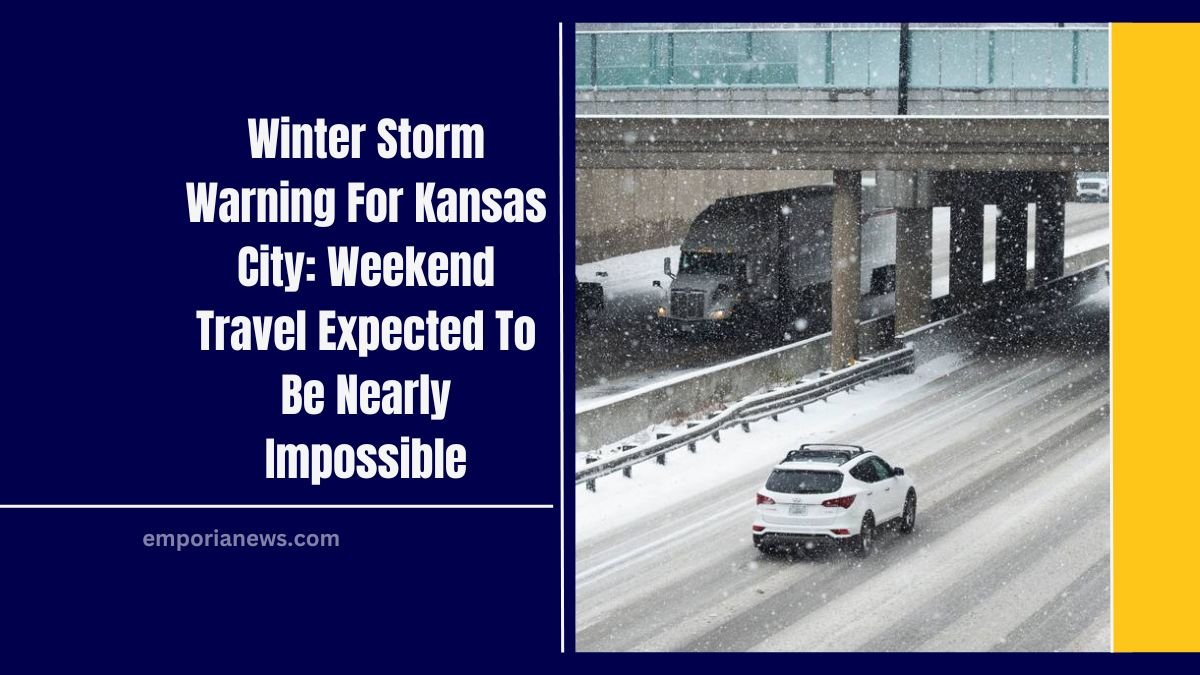
Travel Risks
Road conditions are expected to deteriorate rapidly as the storm progresses. The combination of ice, snow, and high winds will lead to poor visibility and slick roads, making travel nearly impossible by Sunday afternoon.
Safety Tips for Travel
- Avoid Non-Essential Travel: Roads will be dangerous, with near-blizzard conditions in some areas.
- Emergency Supplies: Keep a flashlight, food, water, and blankets in your vehicle if travel is unavoidable.
- Stay Updated: Monitor weather updates and road conditions before venturing out.
Additional Concerns
- Power Outages: Ice accumulation on power lines may lead to outages across the region.
- Bitter Cold: Temperatures are expected to remain below zero, with dangerous wind chills lasting through Thursday.
- Infrastructure Impacts: Freezing conditions may strain local infrastructure, delaying recovery efforts.
Timeline of the Storm
- Saturday Afternoon: Light drizzle and freezing drizzle may begin in western Kansas City areas.
- Overnight into Sunday: Heavy snow and sleet will move into the metro area, significantly worsening road conditions.
- Sunday Afternoon: Peak snowfall and wind gusts up to 35 mph will create hazardous conditions.
- Monday Morning: Temperatures drop to -7°F, with wind chills below -15°F.

This winter storm warning for Kansas City poses a significant threat to weekend travel and daily life, with dangerous weather conditions likely to persist through early next week.
Residents are urged to take necessary precautions, avoid unnecessary travel, and prepare for possible power outages.
Stay informed with updates from the National Weather Service and local authorities as the storm unfolds.
FAQs
How much snow is expected in Kansas City?

Between 8 to 13 inches of snow and sleet accumulation is forecasted by Monday, with the heaviest amounts likely north of I-70.
When will travel be most dangerous?
Travel is expected to become nearly impossible by Sunday afternoon, with high snowfall rates, blowing snow, and icy roads.
What precautions should I take for power outages?
Ensure you have emergency supplies like flashlights, batteries, and non-perishable food. Keep electronic devices fully charged and have blankets ready for warmth.