
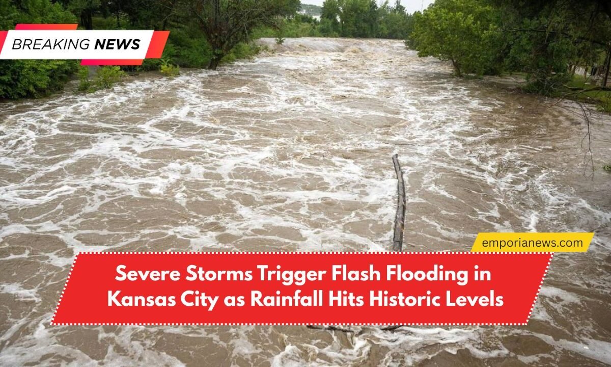
Kansas City faced another round of intense thunderstorms on Monday, with over 3 inches of rainfall recorded in just six hours, prompting widespread flash flooding, particularly in the southern parts of the metropolitan area.
This weather event added to an already waterlogged July for the region, as data from local rain gauges confirmed the deluge.
Tragic Incident Along Negro Creek Trail

A tragic incident occurred when a woman was swept away by fast-moving waters while walking along the Negro Creek trail near West 155th Street and Nall Avenue.
Authorities believe she drowned as a result of the sudden flooding. According to rain gauge data, 2.88 inches of rain fell near Metcalf Avenue, while another 2.28 inches was recorded close to Nall Avenue in the six hours leading up to 2:30 p.m.
Creek Levels Surge Dramatically
Water levels along Negro Creek rose sharply during the storm. Between 9:30 a.m. and 10 a.m., the creek level surged from 3.5 feet to 9.7 feet, an astonishing six-foot rise in just 30 minutes, precisely when the heaviest rainfall occurred.
Another Woman Rescued Amid Rising Waters

In a separate event, another woman narrowly escaped tragedy. She was found clinging to a tree in rising floodwaters from Indian Creek near 103rd Street and Wornall Road. Emergency responders rescued her after a nearby rain gauge showed 1.74 inches of rain had fallen within six hours.
Flash Flood Warnings Surge Across the U.S. in 2025
The National Weather Service (NWS) has issued an alarming 3,160 flash flood warnings across the United States this year as of July 16, according to Iowa State University’s Iowa Environmental Mesonet.
This marks the highest number of flash flood warnings ever recorded during this time frame since record-keeping began in 1986.

These warnings are issued when flash flooding is either imminent or already in progress, highlighting the growing severity of weather events in recent years.
Kansas City’s 2025 Rainfall Events Set New Records
Although Kansas City has received 21 flash flood warnings so far this year — slightly below the historical average — the intensity and volume of rainfall during each event has been exceptional.
In an extraordinary turn, over 2 inches of rain fell on both Wednesday and Thursday of last week, an occurrence that has only happened 12 times in the past 137 years, according to the NWS.
Meteorologists React: “A 1-in-500-Year Event”
Local weather experts have emphasized the rarity and severity of this year’s storms. Fox 4 Weather in Kansas City described the July 17 storm in Johnson County as a “1 in 500 year type of event” in a post on X (formerly Twitter).
Michael Lowry, a meteorologist based in Miami, summed up the sentiment across the weather community:
“2025 has been the year of the flood.“
What Comes Next? More Flooding Likely
With local river and creek levels already running high, the risk for additional flash flooding remains elevated. If more heavy rainfalls continue in the coming weeks, it’s highly probable that further flash flood warnings will be issued, posing ongoing risks to residents and infrastructure.
Kansas City’s recent storm activity is a stark reminder of how rapidly weather patterns are changing. With record-breaking rainfall totals, historic flooding events, and emergency rescues, the city is grappling with the effects of extreme climate conditions.
As the summer progresses, continued vigilance and preparedness will be essential, especially with already elevated water levels and the potential for more storms on the horizon.