
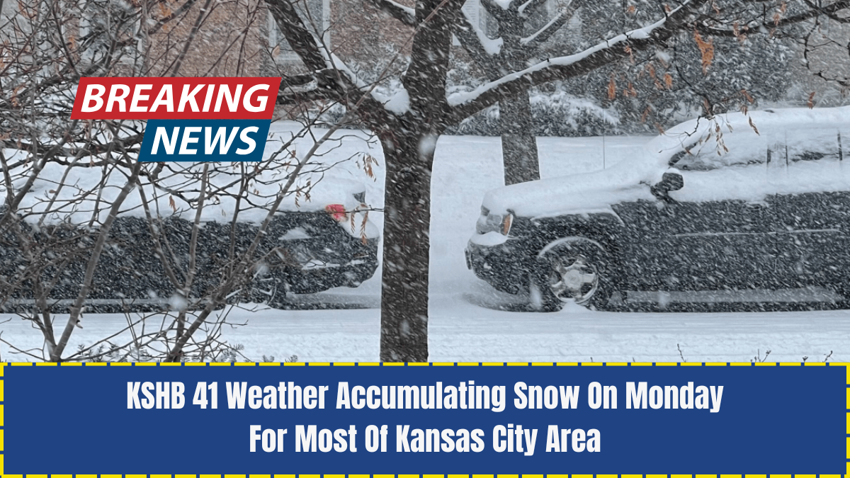
Winter is making a strong return to the Kansas City region as forecasters at KSHB 41 Weather warn of a widespread round of accumulating snow arriving Monday.
Residents across the metro and surrounding counties should prepare for slick roads, reduced visibility, and a quick drop in temperatures as this early-season winter storm system moves through.

With the busy workweek beginning and commuters hitting the roads early, understanding the timing, snowfall totals, and impacts is crucial for everyone’s safety.
This in-depth weather report breaks down everything Kansas City residents need to know—from expected snow amounts to timing, school impact possibilities, advisory information, and expert recommendations.
Understanding Monday’s Weather Setup
Meteorologists at KSHB 41 explain that a moisture-rich disturbance tracking from the southwest will collide with cold air currently in place across the Midwest.

This creates ideal conditions for widespread snow to develop. Kansas City has already experienced a few light flurries this season, but this system is the first significant accumulation event, impacting most of the metro.
Models indicate a steady band of snow developing overnight and continuing through much of Monday morning.
With temperatures hovering near or slightly below freezing, the snow will stick quickly to untreated surfaces, creating travel challenges for the morning rush.
Timing Of Snowfall Across The Kansas City Metro

One of the most important factors for residents is when the snow will begin and end. Here is a breakdown of the expected timeline:
Late Sunday Night (11 PM – 2 AM)
Light snow begins in southern Kansas and gradually moves toward Kansas City. Some neighborhoods may start with flurries or a rain/snow mix.
Early Monday Morning (2 AM – 7 AM)
Snow becomes widespread. Temperatures fall into the upper 20s, increasing accumulation rates. Roads may become slick quickly.
Monday Morning Rush Hour (7 AM – 10 AM)
This is expected to be the peak impact period. Snowfall rates between 0.5 to 1 inch per hour are possible, creating slowed traffic, hazardous driving, and visibility concerns.
Monday Afternoon (12 PM – 3 PM)
Snow gradually tapers off from west to east. Clouds linger, and winds shift, making temperatures feel even colder.
Monday Evening (After 5 PM)
Precipitation ends, but refreezing becomes a risk as the temperature drops into the lower 20s.
Expected Snowfall Totals
KSHB 41 Weather meteorologists forecast 1–4 inches of snow across much of the Kansas City region, though some pockets may see slightly higher amounts depending on the storm track.
Snowfall Range by Region
- Kansas City Metro: 2–3 inches
- North of the River (Platte, Clay, Clinton counties): 3–4 inches
- South Kansas City & Johnson County: 1–2 inches
- Eastern Counties (Jackson, Lafayette): 2–3 inches
- Western Fringe: 1–2 inches with lighter coverage
Localized bursts could push some areas toward 4.5 inches, especially north and northeast of downtown Kansas City.
Winter Weather Advisories & Alerts
As of the latest updates, several counties are under a Winter Weather Advisory beginning late Sunday night through Monday afternoon. These advisories signal that travel disruptions are expected due to accumulating snow and low visibility.
Residents are encouraged to:
- Check for updates from local emergency management
- Monitor changing conditions through KSHB 41 alerts
- Allow extra travel time Monday morning
- Keep emergency supplies in their vehicle
Impact on Roads, Travel & the Monday Morning Commute
With temperatures below freezing, the snow will stick quickly to untreated surfaces. Even though road crews will be active through the night, slick and snow-covered roads are expected during the Monday morning commute.
Primary Concerns Include:
- Snow-packed bridges and overpasses
- Reduced visibility during heavier bursts
- Slower-than-usual highway speeds
- Early-morning traffic delays
- Potential school bus route impacts
Commuters should plan ahead by leaving earlier than usual, checking traffic conditions, and being prepared for longer travel times.
Will Schools Be Affected?
While widespread school closures are not guaranteed, the timing and intensity of the snowfall—arriving ahead of the morning commute—could lead to:
- Delayed start times
- Remote learning decisions
- Canceled bus routes in harder-hit areas
Parents should monitor district announcements closely Sunday evening and Monday morning.
Expected Temperature Drop & Wind Chills
Beyond snowfall, Monday will feel much colder across the metro. After the system passes, winds from the northwest will pull in a colder air mass.
Temperature Forecast
- Morning: 27–30°F
- Afternoon: 29–33°F
- Evening: 21–24°F
Wind Chills
Wind chills may fall into the teens, especially after sunset.
This increase in cold air also raises concerns for icy patches forming on untreated roads, sidewalks, and parking lots Monday evening and overnight.
Why This System Matters for the Season
Although this is not a major winter storm, it is significant for several reasons:
- First true accumulating snow of the season for many residents.
- Perfect timing to disrupt Monday travel.
- Ground temperatures are cold enough for snow to stick quickly.
- Signals arrival of a longer cold pattern expected in December.
Meteorologists also highlight that this system may hint at future storms, as the jet stream pattern becomes more active across the Midwest.
How to Prepare for Monday’s Snowfall
Proper preparation can reduce risks and keep families safe during winter weather events. Experts recommend the following:
1. Prepare Your Vehicle
- Check tire pressure and tread
- Fill windshield washer fluid
- Carry an emergency winter kit
- Keep gas tank at least half full
- Drive with headlights on
2. Prepare Your Home
- Bring pets indoors
- Protect outdoor faucets and hoses
- Stock ice melt or sand for walkways
- Set thermostats appropriately
3. Adjust Your Monday Schedule
If possible:
- Work from home
- Allow extra time for travel
- Leave early to avoid peak traffic delays
4. Stay Informed
Follow:
- KSHB 41 Weather app
- Local news updates
- NWS Kansas City alerts
Reliable updates are essential as forecast details continue to shift.
Post-Storm Conditions: What to Expect Tuesday
After the snow ends Monday evening, Kansas City will remain in a cold pattern. Tuesday morning lows could drop into the upper teens in some areas, raising concerns for black ice on roads.
Road crews will continue treatment overnight, but all drivers should use caution during early Tuesday commutes.
Kansas City residents should prepare for a cold and snowy start to the week as accumulating snow moves into the metro early Monday.
With 1–4 inches expected, the timing of this system—combined with freezing temperatures—will create challenges for the Monday morning commute and could impact school schedules.
Staying informed, using caution on the roads, and preparing your home and vehicle ahead of time are the best ways to remain safe.
KSHB 41 Weather will continue providing detailed updates as the system approaches, ensuring residents have the latest information needed for a safe Monday.
FAQs
How much snow will Kansas City get on Monday?
Most of the metro is expected to receive 2–3 inches, with locally higher totals north of the river.
When will the snow begin?
Light snow starts late Sunday night, becoming widespread early Monday morning and peaking around the morning commute.
Will schools close due to the snow?
Closures are not guaranteed, but delays or remote learning options are possible depending on road conditions.