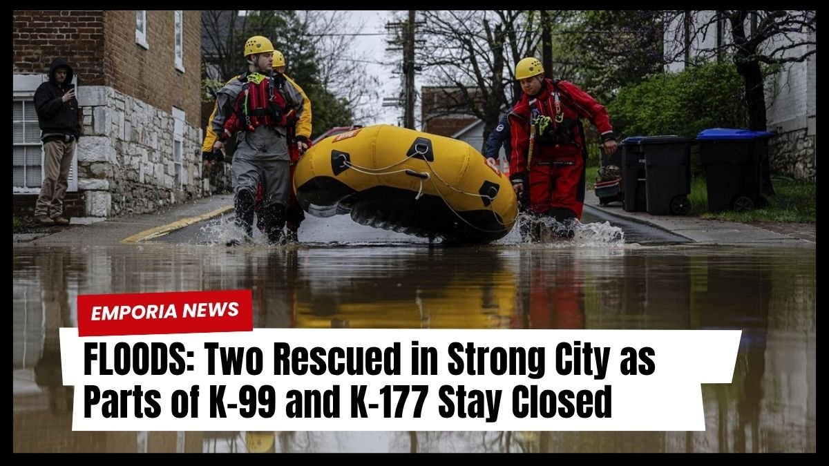
River flooding continues to pose serious challenges throughout the KVOE listening area, following heavy downpours on Tuesday.
Floodwaters have resulted in multiple emergency rescues, road closures, and significant disruptions to local travel and services.
First-Ever Drone-Assisted Water Rescue in Emporia
On Wednesday morning, Emporia Fire Department responded to a water rescue along Road C, just north of US Highway 50.
Firefighters safely guided the stranded vehicle driver to higher ground after locating them using a drone, marking the first real-world deployment of this new rescue tool. EFD Training Officer Matt Luder confirmed the operation proceeded without complications.
Strong City Rescues Amid Rising Waters
Later that day, Chase County emergency crews, supported by various fire departments, conducted two separate water rescues south of downtown Strong City.
Sheriff Jacob Welsh reported that as rescuers checked on one resident, another nearby individual requested help. Both were evacuated using rescue boats and are now safe.
These incidents, along with a rescue south of Emporia on Tuesday, reflect the scale of this week’s flooding and its impact across multiple counties.
Major Highways Shut Down Due to Floodwaters
Rising river levels have forced the closure of several key highways:
| Highway | Status | Cause |
|---|---|---|
| K-99 (North of Emporia) | Reopened briefly, then closed south of town | Cottonwood River rose above 25 feet |
| K-177 | Closed between Cottonwood Falls and Strong City | River exceeded 12.2 feet |
| K-68 (Osage-Franklin County line) | Closed | Marais des Cygnes River 11 feet above flood stage |
Detour routes have been established, but drivers are urged to use caution and avoid flooded roadways.
Emporia and Surrounding Communities Struggle with Access
Access to towns like Saffordville and Plymouth remains highly restricted. Sheriff Welsh confirmed that Saffordville is currently submerged, while Roads B-2 and B-5, leading to Plymouth, are impassable due to flooding.
Emporia Fire also reported its second rescue in two days, helping a person near Roads 140 and H after flooding began early Wednesday morning.
Local Events Disrupted by Storm Damage
The week’s storms have also caused community disruptions. The Jones Aquatic Center is closed indefinitely due to lightning damage to a pump, while the Emporia Municipal Band may relocate its Thursday concert depending on the weather, either at Peter Pan Park or Albert Taylor Hall.
Road Closure Updates for Lyon County and Surrounding Areas
Numerous roads remain closed, particularly in Lyon County, where over 40 segments are underwater. Meanwhile, some previously blocked roads have reopened.
Selected Lyon County Road Closures
- Road 50 from Highway 99 to Road R
- Road 140 between Road J and Highway 99
- Road 150, 160, 165, 170, and others impacted by widespread flooding
Recently Reopened Roads
- Road 130 from Road R to S
- Road G from Road 50 to Road 60
- Road M from Road 110 to Road 115
Neighboring County Updates
- Chase County: Road B, Lake Road, G Rd, PR Rd, and more are closed
- Coffey County: [Road map available online]
- Greenwood County: Hwy 58, State Street Bridge, and others
- Osage and Morris Counties: Multiple town roads and rural routes flooded
River Release Levels and Warnings
The US Army Corps of Engineers reports the following lake discharge rates:
- John Redmond Reservoir: Nearly 5,000 cubic feet/second
- Melvern Lake: 20 cfs
- Council Grove Reservoir & Fall River State Lake: Under 10 cfs
Flood warnings continue for numerous area rivers. Residents are advised to monitor official updates for the latest gauge data and forecasts.
Recorded Rainfall Totals Across the Region
Rainfall accumulation across the region ranged from 2.5 inches to over 7 inches, with significant impact zones listed below:
| Location | Rainfall Total (inches) |
|---|---|
| Madison | 7.15 |
| Neosho Rapids | 6.80 |
| Hartford | 6.50 |
| Olpe Jones Park | 6.50 |
| Roads 30 & U | 6.93 |
| 3.5 miles west of Emporia Golf Course | 6.80 |
| Burlington | 5.05 |
| Saffordville (nearby) | 6.00 |
Rain-Related Accidents and Injuries
A Kansas Turnpike accident Wednesday morning involved 44-year-old Julia Hart of Wichita, whose SUV hydroplaned and collided with a semi-truck.
She was transported to Newman Regional Health with potential injuries. Another vehicle fire was reported near mile marker 116 later in the morning; details are still pending.
More Rain Expected, But Less Severe
According to the National Weather Service, additional rainfall is forecast from Thursday night through Sunday, although totals are not expected to match this week’s intensity. Meteorologist Kyle Poage says the previous week’s heavy rains created the conditions for this severe flooding.
The recent wave of heavy rain has left much of the KVOE listening area flooded, forcing road closures, emergency rescues, and community disruptions.
With continued rainfall expected and river levels still high, residents are urged to remain vigilant, avoid flooded areas, and follow all safety advisories. Emergency services are active across counties to manage rescues, closures, and support recovery efforts.


