
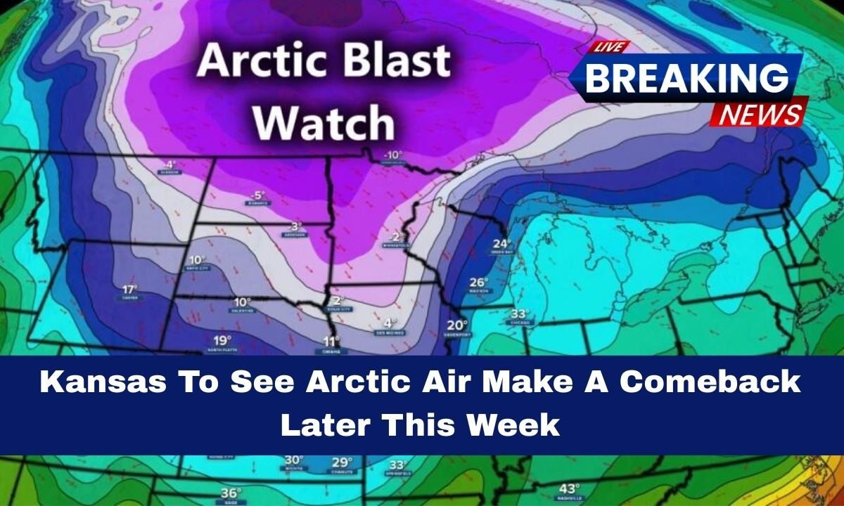
A fresh surge of Arctic air is forecast to return to Kansas later this week, marking another period of significantly cold weather after a brief warm‑up earlier in the week.
Forecasters predict below‑normal temperatures, single‑digit lows, and the possibility of light snow or flurries as this Arctic front moves southward.

This cold air influx is part of a larger North American winter storm pattern affecting the central United States during late January 2026.
Forecast Overview: What Weather To Expect
The incoming Arctic air mass will begin to impact Kansas mid‑week and continue into the weekend, bringing a notable drop in both daytime and nighttime temperatures.
After a few days of relatively milder weather with highs near or slightly above freezing, temperatures will trend sharply colder.

Expected conditions include:
- Daytime highs dropping to the 20s to low 30s Fahrenheit
- Morning lows plunging into single digits
- Wind chills feeling much colder than actual temperatures
- Light snow or flurries possible but no major snow accumulation expected
This pattern contrasts with earlier in the week, when temperatures briefly warmed before declining again.
Temperature And Weather
| Day | Weather Condition | Expected Temperatures |
|---|---|---|
| Earlier in Week | Mild for winter | Highs near freezing |
| Mid‑Week | Cold air surge begins | Highs 30s |
| Thursday | Arctic air pushes in | Highs 20s to low 30s |
| Friday | Peak cold period | Highs 20s, Lows single digits |
| Weekend | Continued cold | Wind chills very low |
This table shows how temperatures will shift through the week as the Arctic front settles in and reinforces colder conditions.
Snow, Flurries And Winds

While major snowfall totals are not expected with this Arctic air return, there is a chance of light snow flurries late in the week in some areas of Kansas as the cold front passes through.
Winds will also play a role, with gusty conditions making temperatures feel even colder through wind chill effects.
The wind chills could make it feel well below freezing, increasing the risk of frostbite during prolonged exposure. Road conditions may become slick early in the morning or late at night when temperatures dip below freezing and any moisture on the surface refreezes.
Impact On Daily Life And Travel
As Arctic air settles across Kansas:
- Outdoor activities may become uncomfortable or unsafe during the coldest hours, especially early mornings.
- Commutes could be impacted by icy patches on roads due to refreezing.
- Schools and workplaces might experience delays if icy conditions persist.
- Heating systems will likely run continuously as residents try to stay warm during the coldest period.
Residents should ensure that vehicles are winter‑ready, pipes are insulated to avoid freezing, and pets receive proper shelter.
Regional Context: Winter Storm Connection
This Arctic air arrival is linked to a broader January 2026 North American winter storm, which developed from an interaction between an elongated polar vortex and moisture from the Pacific and Gulf of Mexico.
The result has been cold air plunging into the central and eastern United States with wintry weather impacts extending far beyond Kansas.
The return of Arctic air to Kansas later this week is set to bring a significant cold blast with below‑normal temperatures, single‑digit lows, and the chance of light snow flurries.
While not expected to be a major snow event, the cold air will make wind chills dangerously low and could affect travel, outdoor activities, and daily routines across the state. Kansans should prepare for a chilly end to January and stay tuned for updated weather information through the weekend.