
Southern California finally received much-needed rain and snow, bringing relief to a region battered by relentless dryness and unprecedented wildfires.
After weeks of extreme fire weather, the first major storm of the season swept through the area, offering a respite and a chance for recovery.

However, while the rainfall and snowfall provided temporary relief, experts caution that the region remains vulnerable to wildfire risks and potential debris flows.
Rain and Snow: A Welcome Relief
The storm brought varying levels of precipitation across Southern California, with Los Angeles County seeing rainfall totals ranging from 0.5 inches to 1.62 inches.
Higher elevations received significant snowfall, with some peaks accumulating more than a foot of snow. The rainfall and snow brought hope to a fire-weary region but also created challenges, including road closures and localized flooding.
Rainfall Totals in Key Areas
| Location | Rainfall (inches) |
|---|---|
| Porter Ranch | 1.62 |
| Sepulveda Canyon | 1.45 |
| Santa Monica Pier | 1.38 |
| Agoura Hills | 0.33 |
| Alhambra | 0.49 |
Wildfires and Dryness: A Precursor to the Storm

Southern California has endured record-breaking dryness over the past months, fueling unprecedented wildfires across the region.
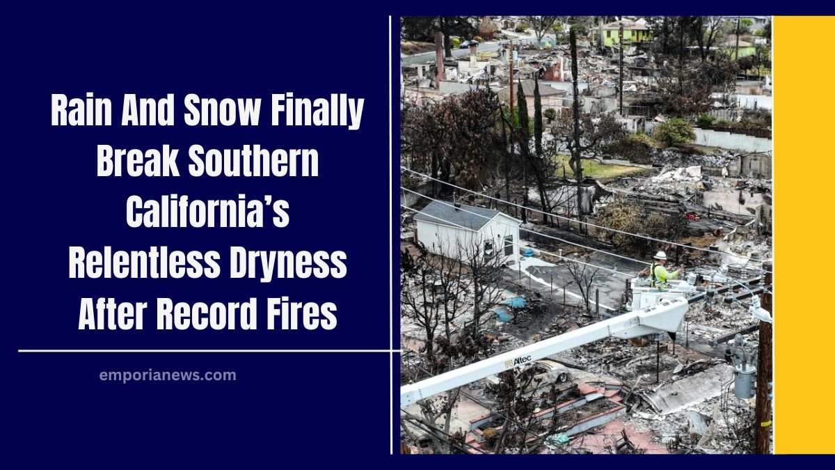
Burn scars left behind by fires like the Palisades Fire and Eaton Fire have heightened concerns about debris flows and flooding, especially during heavy rain events.
Key Challenges from Wildfires
- Soil Hydrophobicity: Wildfire heat makes soil water-repellent, increasing the risk of rapid water runoff.
- Burn Scars and Debris Flows: Burn areas are particularly vulnerable to mudslides and debris flows, which can destroy infrastructure and threaten lives.
- Lingering Fire Risks: Despite the rain, experts warn that Southern California’s fire season may still extend into February, requiring an additional 2-4 inches of rainfall to fully mitigate risks.
Storm Impact Across the Region
Road Closures and Flooding
The storm caused significant disruptions to transportation:
- 5 Freeway Closure: Snow accumulation of up to 3 inches shut down the Grapevine for more than 12 hours, reopening only after extensive clearing.
- 101 Freeway: Flooding in downtown Los Angeles briefly closed southbound lanes but was resolved by rush hour.
- Pacific Coast Highway (PCH): Mudslides and debris closed portions of the PCH, along with canyon roads like Topanga Canyon Boulevard, which saw inches of sludge blocking access.
School Closures

In Malibu, the Santa Monica-Malibu Unified School District closed four schools due to dangerous road conditions, highlighting the storm’s impact on daily life.
Localized Heavy Rain and Snowfall
While the storm provided relief, its effects varied across the region:
- Localized Rainfall: Rain rates exceeded 0.5 inches per hour in some areas, such as the north end of Las Virgenes Road near the Santa Monica Mountains. These rates raised concerns but luckily avoided the most vulnerable burn scars.
- Mountain Snowfall: Higher elevations, including Mt. Wilson and Arrowbear Lake, received between 1 and 12 inches of snow, creating picturesque but hazardous conditions.
Fire Weather vs. Beneficial Rain
Meteorologists described the storm as “largely beneficial” for firefighting efforts, as it dampened the dry conditions that had fueled Southern California’s fires. However, they also cautioned that the rainfall was insufficient to fully alleviate fire season risks.
- Rain Shortfall: Los Angeles County requires 2-4 inches of rain to definitively end fire season, but most areas received between 0.5 and 1.5 inches.
- Localized Risks: Although heavy rain avoided the largest burn scars, areas like Santa Barbara County saw potentially dangerous rain rates, reviving memories of the deadly 2018 Montecito mudslide.
A Look at the Numbers
| Metric | Details |
|---|---|
| Highest Rainfall Total | 1.62 inches (Porter Ranch) |
| Mountain Snowfall | Up to 12 inches (Arrowbear Lake, Mt. Wilson) |
| Freeway Closures | 5 Freeway (12 hours), PCH, canyon roads |
| Fire Season Rainfall Needed | 2-4 inches (current total: 0.5-1.5 inches) |
Long-Term Risks and Recovery
Although the rain and snow provided temporary relief, Southern California’s challenges are far from over. The risk of wildfires, debris flows, and flooding remains a pressing concern. As the region continues its recovery, residents and officials must remain vigilant:
- Debris Flow Risks: Burn scars remain vulnerable to future storms. Mud, rocks, and debris could still cause significant damage if heavier rains hit.
- Fire Weather Extension: With insufficient rain to end the fire season, firefighters remain on alert for potential flare-ups in dry areas.
- Infrastructure Repairs: Cleanup efforts are ongoing for roads and schools affected by mudslides and flooding.
The long-awaited rain and snowstorm brought much-needed relief to a parched and fire-ravaged Southern California, but it is not a definitive solution.
While the storm helped dampen dry conditions and provided a brief respite from fire weather, the region still faces significant challenges, including the risk of debris flows and the continuation of the wildfire season.
Southern Californians must balance relief with caution as they rebuild and prepare for future storms. The need for sustainable solutions—such as improved water management and fire prevention strategies—has never been more critical in the fight against climate-driven weather extremes.
For now, the storm offers a glimmer of hope in a region that has endured so much, but the road to full recovery is still ahead.